
ABES geoDes
Modelling tool for segmental bridges
- Models built from first principles
- Full 3D representation
- Ensures castability and constructability
ABES geoDes
Modelling tool to generate detailed 3D models of segmental bridges, fully reflecting casting yard requirements and construction site conditions.
General Functions
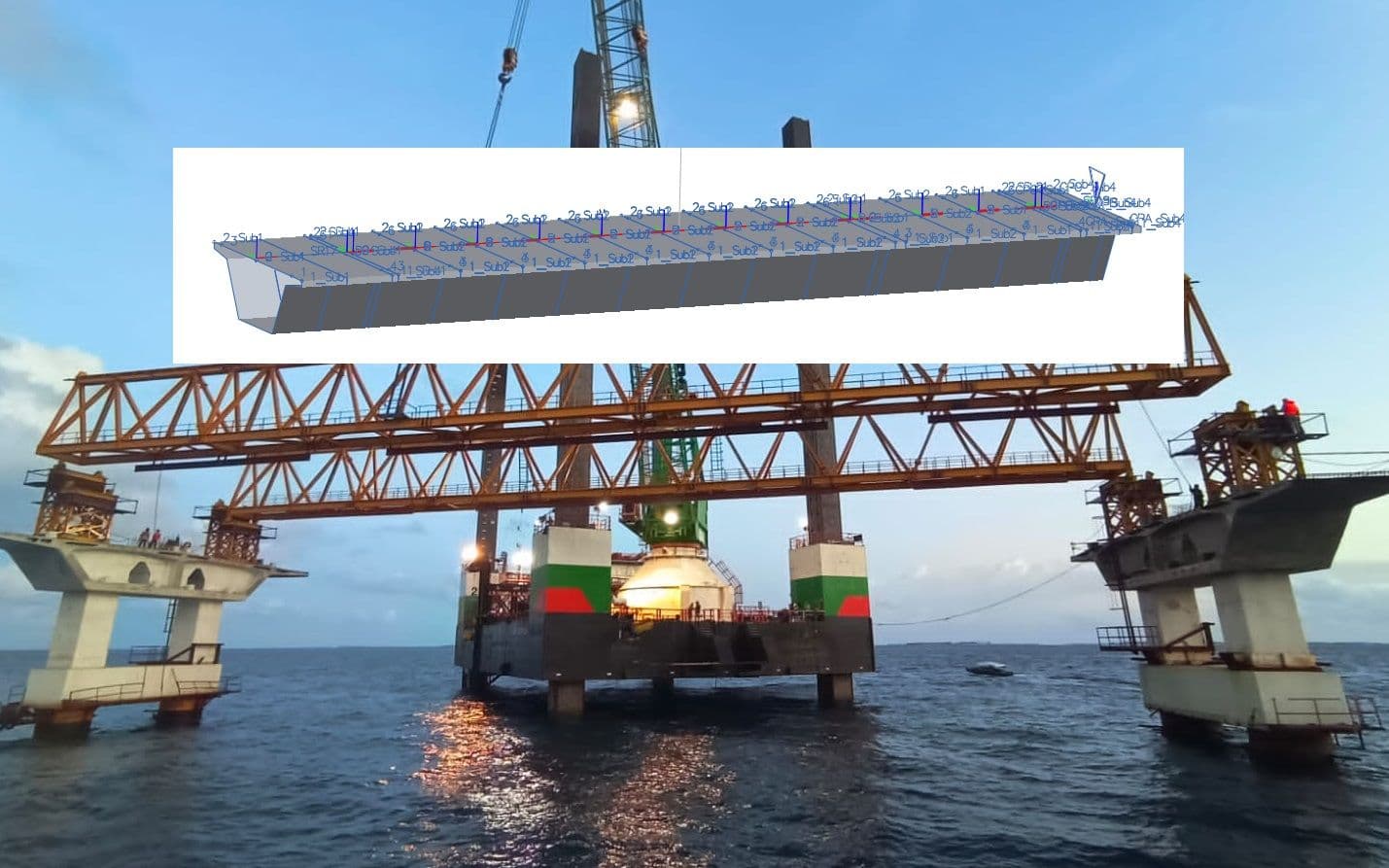
ABES geoDes calculates the detailed 3D geometry of each segment on a bridge individually, following the geometric rules established by the user.
- Various segment types include match-cast segments, pier segments, cast-in-situ segments, stitches, expansion joints etc.
- Casting sequence effects accounted for in segment geometry
- Combination of pre-cast and in-situ segments
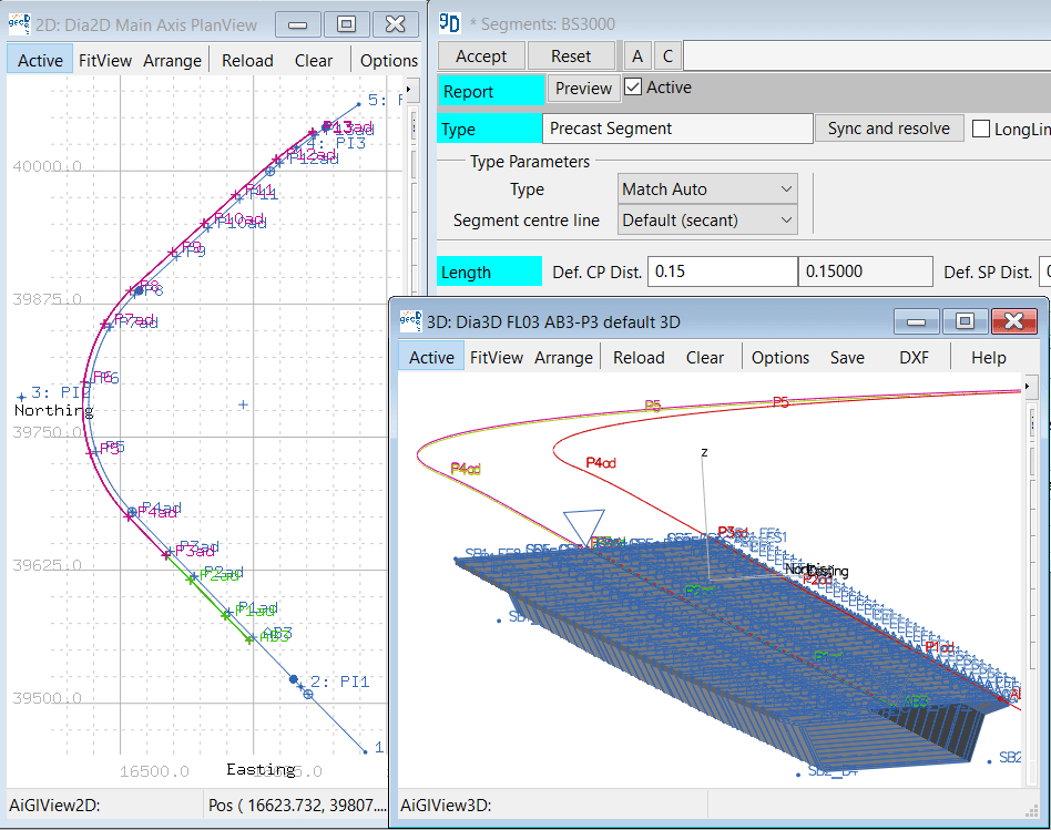
- Each segment placed on 3D road alignment in a secant or tangential position
- Full accounting of cross-fall, gradient, and plan view geometry of the bridge alignment
- Unlimited number and free positioning of geometry control points within each segment

Road and Railway Bridges
ABES geoDes includes a full suite of functions to define or replicate road and railway alignments.
- Unlimited number of road alignments can be combined within one model
- Alignments can consist of straights, many types of transition curves, and arcs in plan view
- Straight lines, arcs, and parabolic curves in elevation
- Secondary alignments at variable horizontal and vertical offsets
- On-ramps and off-ramps, intersections, fly-overs, etc.
- Flexible input options available to define sub-structure

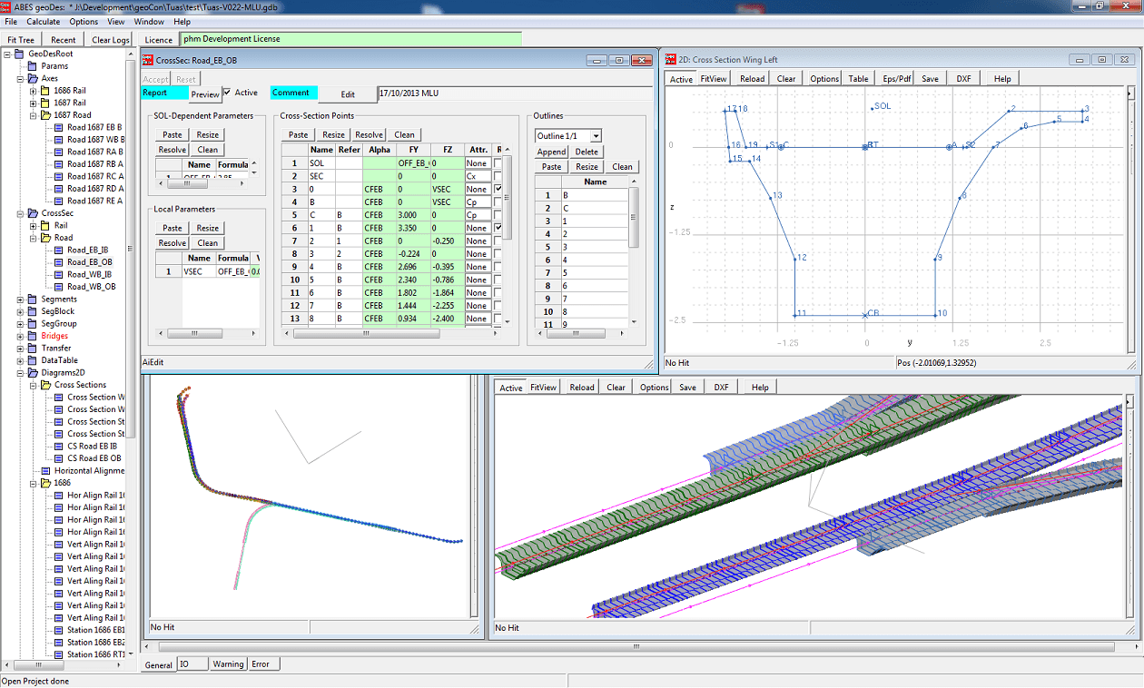
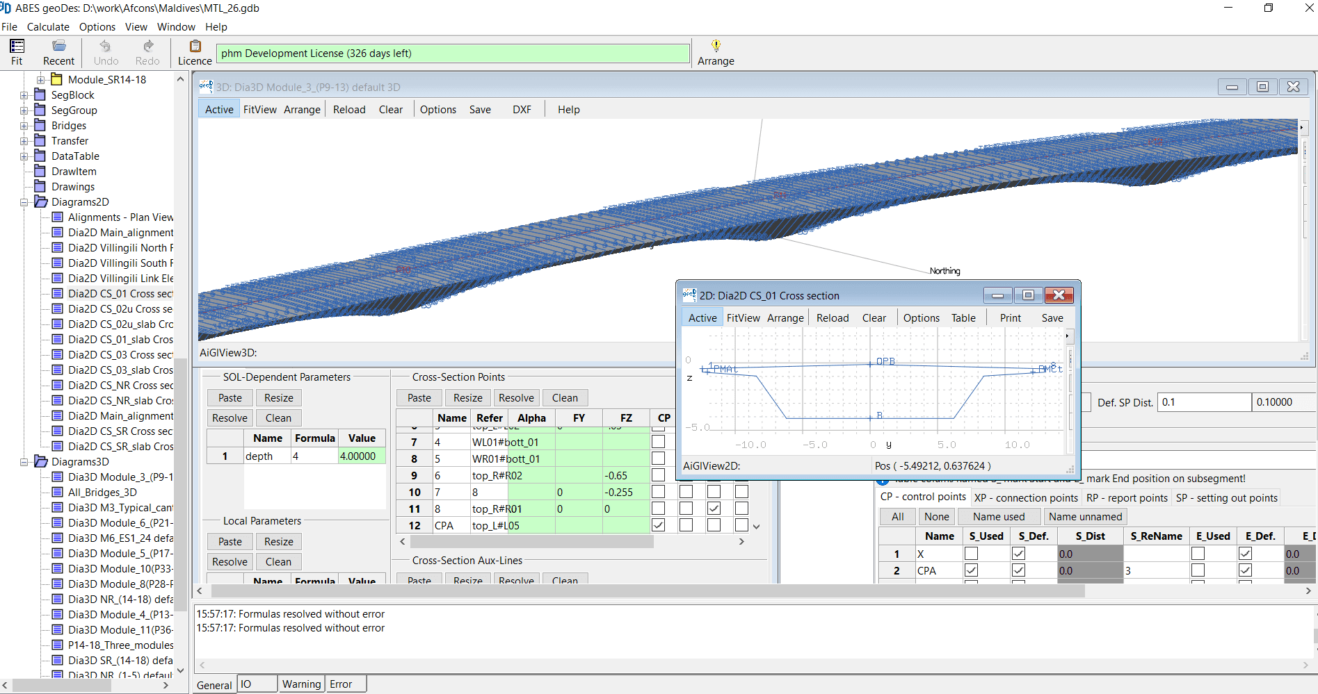
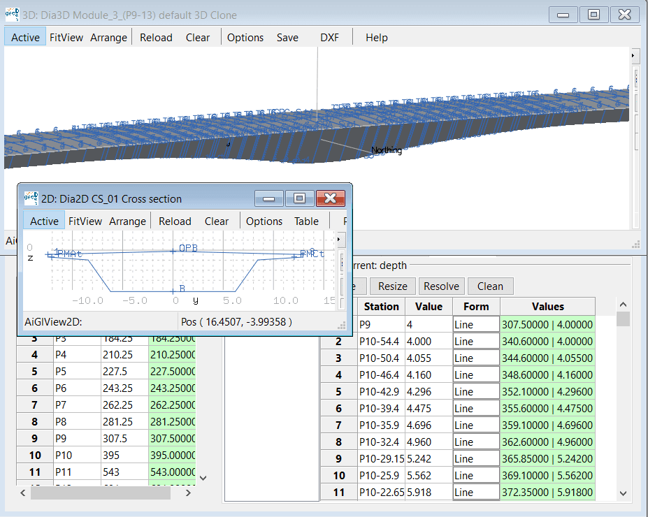
Parametric Cross-Sections
ABES geoDes allows for parametric cross-section macros with variable measurements adapting along road alignment.
- Simple definition of haunched girders, stepped plates, or diaphragms etc.
- Variable measurements defined by tables or mathematical formulas
- Auxiliary lines to support complex geometric relationships
- Unlimited number of cross-sections to be combined within one model
- Cross-sections consist of unlimited number of outline polygons
- Each point on a cross-section can be assigned additional properties for reporting purposes, or to serve as control points for geometry control
Typical Segment Groups
ABES geoDes manages typical segment groups (e.g. typical spans or cantilevers) to facilitate rapid data input for long and repetitive structures
- Facilitate rapid data input for long and repetitive structures - e.g. typical spans or cantilevers
- Joint orientations to reflect bridge alignment (plan view and gradient) and casting yard realities (bulkhead orientations, segment centre lines etc.)
- Exact consideration of bearing locations and sub-structure connections
- Flexible definition of casting sequences
- Long-line and short-line casting, and any combination thereof
- Inclusion of stay cable anchors
- Consideration of pre-camber
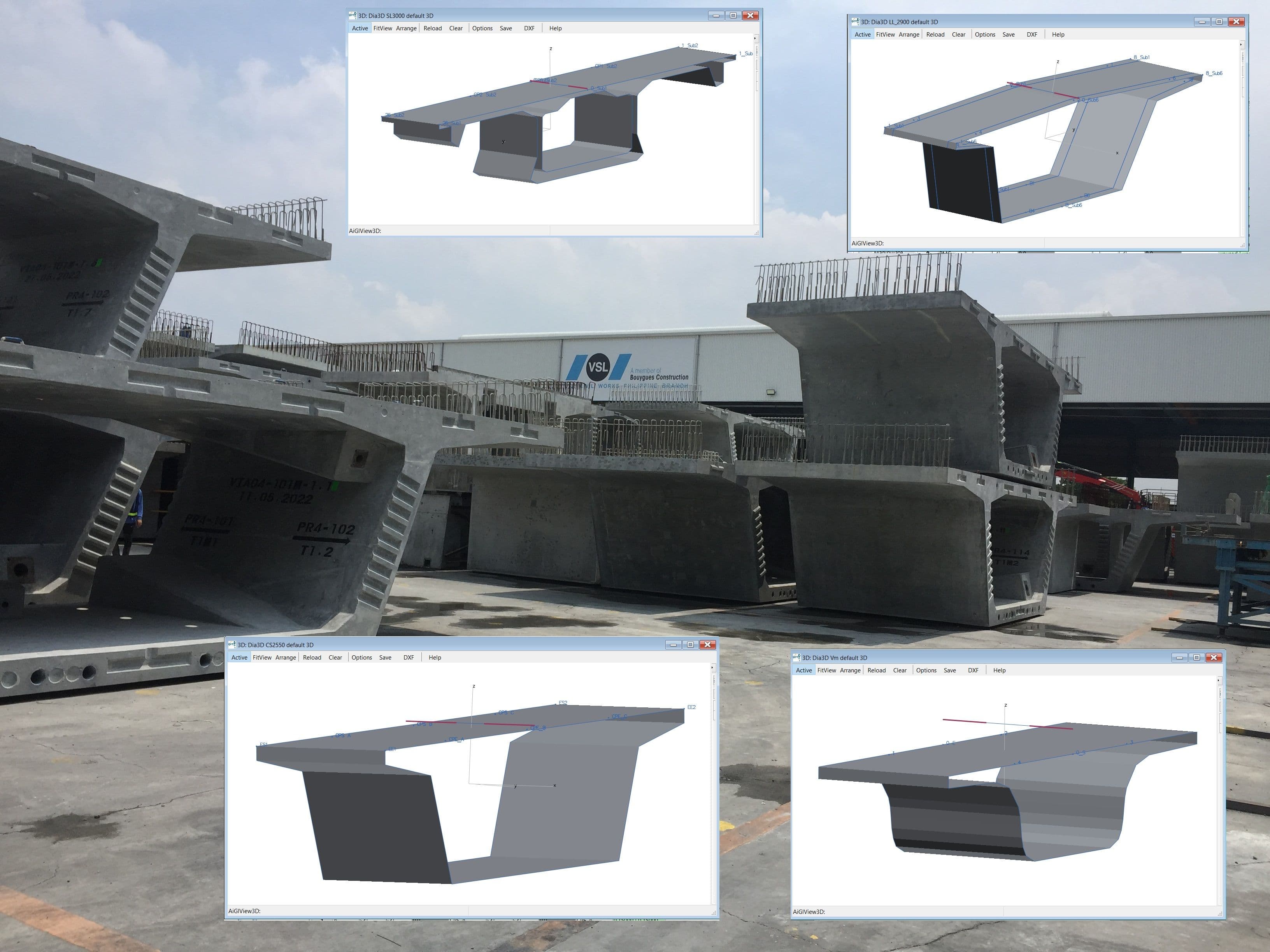
Detailed 3D Geometry of Each Segment
ABES geoDes calculates the detailed 3D geometry of each segment on a bridge individually. Casting yard and construction requirements are observed while following the geometric rules established by the user.
- Ensures castability and constructability
- Various segment types include match-cast segments, pier segments, cast-in-situ segments, stitches, expansion joints etc.
- Casting sequence effects for long-line and short-line casting as well as in-situ casting are accounted for in joint orientations
- Combination of pre-cast and in-situ segments
- Each segment placed on 3D road alignment in a secant or tangential position according to user-defined rules
- Unlimited number and free positioning of geometry control points within each segment
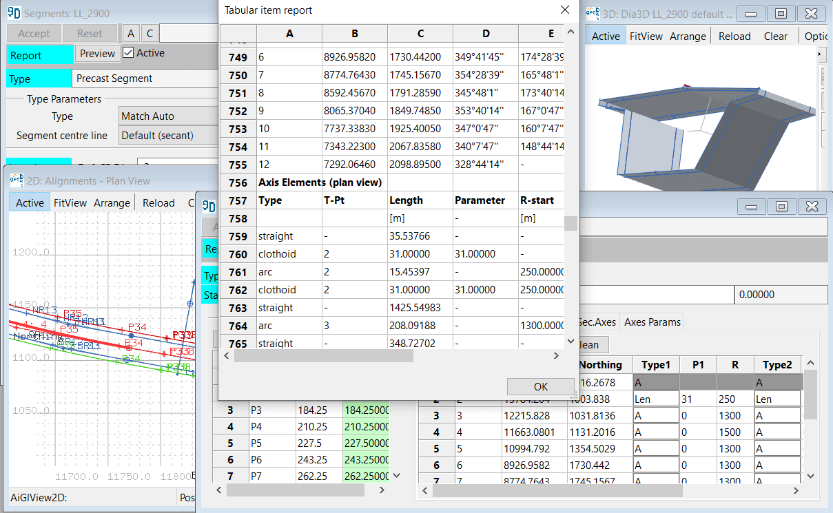
Graphical User Interface, Numerous Output Data Formats
- Instant 3D and 2D Graphical visualisation
- Table-driven data input, cut-and-paste from and to standard spreadsheet programs
- Many tools for plausibility checks
- Automated reports in .pdf format
- Filters for data selection
- CAD-compatible .dxf output files
- Text output
- .png and .eps graphic output files